Project Is Supported by $784,000 Grant from the National Science Foundation

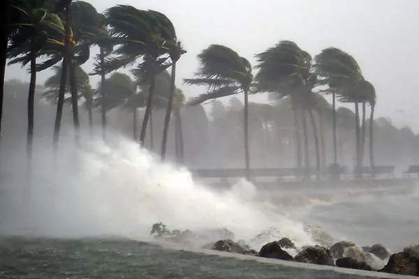
Storms can batter the coast with strong winds, pounding waves, heavy rainfall and storm surges. The photo shows Hurricane Irma slamming the southern coast of Florida in September 2017.
09/30/2020
By Edwin L. Aguirre
Asst. Prof. James Heiss of the Department of Environmental, Earth and Atmospheric Sciences (EEAS) is leading a team of researchers who are studying how powerful coastal storms affect the fresh water flowing below the ground along the seashore.
Heiss and the Woods Hole Oceanographic Institution were awarded a three-year, $784,000 National Science Foundation grant for the project. They will monitor beach aquifers, the underground layer of rocks and other loose materials, such as sand and gravel, that holds water.
“Our goal is to study the effects of coastal storms, including storm surges, intense rainfall and shoreline erosion, on groundwater flow and mixing patterns between seawater and fresh groundwater in beach aquifers,” says Heiss, who is the principal investigator for UMass Lowell on the project.
UMass Lowell’s share of the funding is nearly $497,000; the rest goes to the Woods Hole Oceanographic Institution.
According to Heiss, the roles of more predictable processes that affect groundwater flow – like tides and seasonal changes in rainfall – are generally understood. The effects of coastal storms, however, are more difficult to characterize because they bring intensified factors such as pounding waves, heavy rains and beach erosion that interact with one another.

Beach aquifers provide a valuable ecological service by chemically filtering groundwater contaminants prior to discharge to the ocean. This filtering ability depends on groundwater flow and mixing patterns between fresh water and seawater in beach aquifers.
More broadly, as sea level rises and coastal storms become more frequent and intense due to climate change, more seawater will get introduced into coastal aquifers.
“The intrusion of saltwater is a major problem in many coastal communities and large cities that rely on groundwater as a source of drinking water,” Heiss notes. “In beach aquifers, the increasing salinity will also likely influence the aquifers’ ability to remove nutrients and other pollutants before discharging to the ocean.”
Nutrients, particularly nitrogen in the form of nitrate, along with phosphorus, mercury and other harmful chemical contaminants from human activities, are transported in groundwater to the sea, so it is important to understand the physical movement of groundwater in these environments, explains Heiss.
“Excess nitrogen in coastal waters can cause algal blooms, mass die-offs of fish and loss of biodiversity, which can impact the environment and coastal economies,” he says. “Red tides, blue-green algae and cyanobacteria release toxins that can be harmful to humans, pets, fish, shellfish, marine mammals and birds.”
An Important Ecosystem
According to the U.S. Environmental Protection Agency, excess nitrogen in groundwater comes mainly from animal manure and chemical fertilizers in agriculture, as well as from stormwater and wastewater from sewers and underground septic systems.
Chemical reactions taking place in the saltwater-fresh water mixing zone in beach aquifers, however, can remove nutrients before the groundwater gets discharged through beach aquifers to the sea.

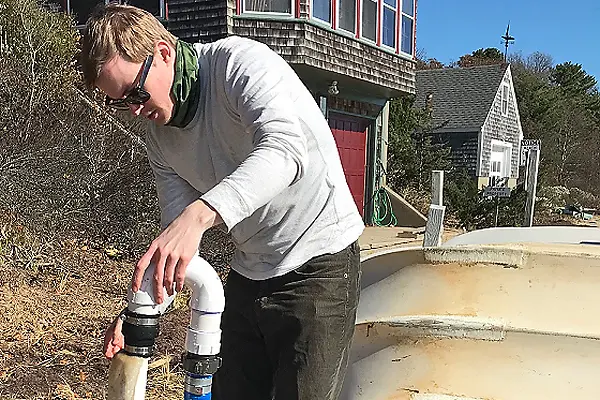
Asst. Prof. James Heiss is collaborating with other researchers from UMass Lowell and the Woods Hole Oceanographic Institution in developing a wireless water-quality sensor network to monitor beach groundwater during a storm.
Heiss is working with Computer Science Prof. Fred Martin and undergraduate students to develop a wireless water-quality sensor network to monitor beach groundwater during a storm. Current and former students who have contributed to the project include Christopher Leary (EEAS), Sam Patriquin, Charlie Mirabile, Grace Chin, Joel Savitz, Peter Woislaw, John Swanson and Zachary McCann (computer science), and Eric Viscione (mechanical engineering).
Heiss and his research team will conduct the water-quality sensor field experiment next year at the U.S. Army Corps of Engineers Field Research Facility in Duck, N.C.
“This facility has specialized equipment, expert staff and dedicated beach access,” he says. It features a concrete and steel research pier that extends 1,840 feet from the dune to the Atlantic.
“The sensor network we are developing will be installed in monitoring wells on the beach in the summer ahead of the hurricane season,” Heiss says. “The wells and sensors will stay in place for a few months to record groundwater parameters at various depths as storms pass over the study site. The sensors will send the readings via cable to a data logger on the beach surface, and the data logger then transmits the information wirelessly to a base station behind the dune line.”
